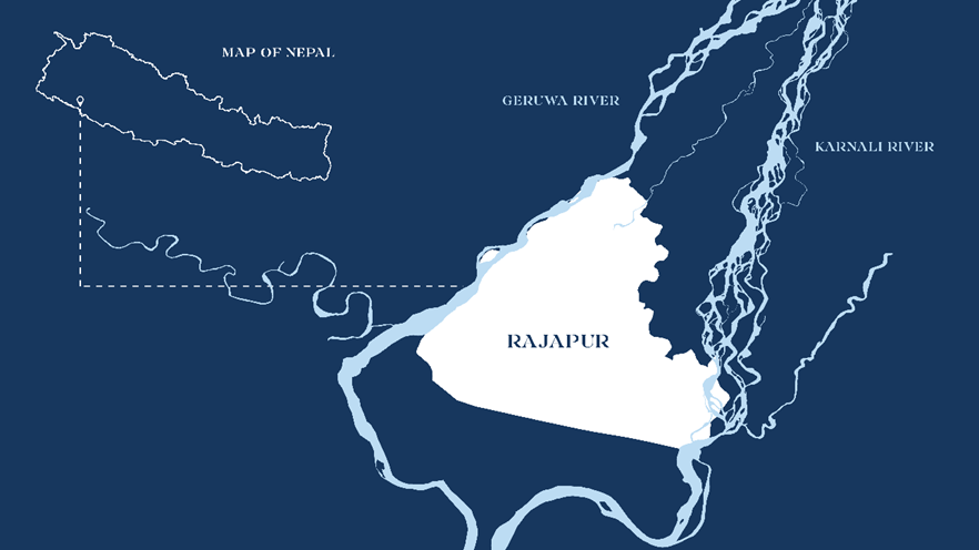
Every year in Nepal, the Rajapur Municipality is impacted by floods and the Bhotekoshi Municipality is impacted by landslides. The Rajapur Municipality is located between the Karnali River and the Geruwa River and faces flood risks due to its flat topography. Unfortunately, there is a discrepancy in the understanding of future climate change scenarios in these regions among scientists, practitioners, and communities. Climate models predict a rise in the magnitude and frequency of extreme weather events. However, there is a knowledge gap hindering local government’s ability to adequately address this issue.
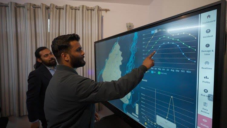
The Bipad Portal is a platform where different disaster datasets such as earthquakes, floods and landslides are brought together from different sources for better planning and decision-making by different organisations, government, private and international agencies. The portal enables decision-makers to assess situations easily and plan accordingly. However, not all municipal staff working at grassroots levels are aware of the portal or how they can utilise data-driven insights for planning and drafting policies.
At Youth Innovation Lab (YI-Lab), we recognised a need for accessible information and developed a module in the Bipad Portal Platform, VisRisk. This module combines various data, including flood risk, municipality demographics, infrastructure, and land details. The interactive map helps make informed decisions by presenting scientific, geospatial data in a visually engaging way.
However, the community faced struggles with the portal as well. Practical challenges such as unstable network connections and users’ unfamiliarity with gadgets hindered progress. Overcoming these challenges and enhancing technical familiarity among municipal officials and community members became an ongoing learning experience for our team.
To bridge this gap, we turned to artistic expression. We aimed to convey the significance of data-driven decisions by employing creative methods, such as a Flood Mural to visually represent risk.
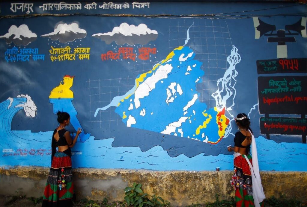
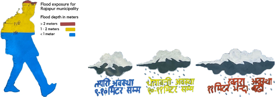
We chose to work with mural art to convey the municipality boundary’s significance, recognising its deeper meaning beyond technical geography. Inspired by the community’s resilience amid floods, we believed that the boundary, resembling a heart, symbolised resilience. This also resonated with our team members who are passionate about art and poetry.
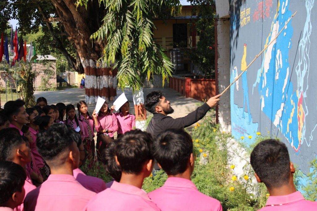
The flood mural is a collaborative effort between Nepal’s National Disaster Risk Reduction Management Authority (NDRRMA), the Department of Hydrology and Meteorology (DHM), Rajapur Municipality, and the Youth Innovation Lab. The activity was carried out first in the classroom where children were allowed to express their experience living with flood through drawings and artistic expression.
In the mural, ominous clouds hinted at relentless rain, conveying a message about future flood risks amidst climate change. The coloured in outline of the child gives perspective, speaking to the water level rise one could experience.
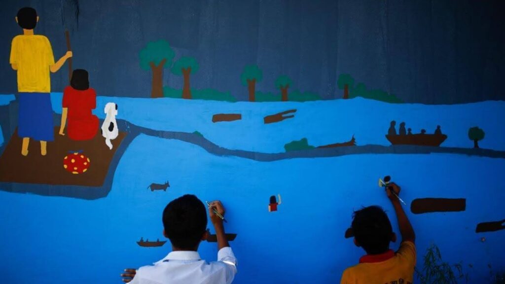
We continued our efforts to bolster community resilience by actively engaging with young people.
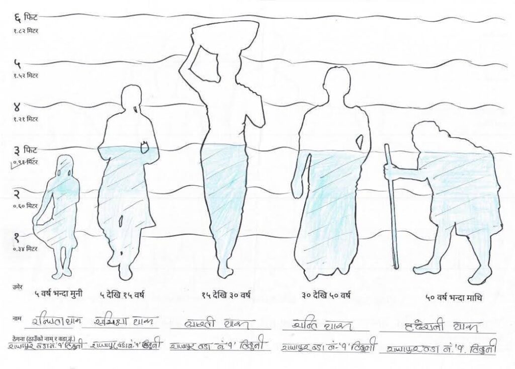
We invited school children to share their knowledge and experiences of floods. Using a silhouette worksheet, the children marked the levels to which floodwaters rose and how these levels affected their relatives from various demographics.
In Rajapur, we were able to bridge the gap between data sets and community engagement in flood risk with the use of an artistic approach. This also turned into a significant learning experience for the team. Encouraged by our success, we aim to replicate the activity in Tikapur for its next chapter. This time, opting to adorn municipal grounds with a mural, seeking to instill awareness among both officials and the community. We hope the municipal members will embrace the art, explore the Bipad Portal, and champion its use in planning and development.
Photo credit: Youth Innovation Lab